

Caneel Hill Trail Round Trip
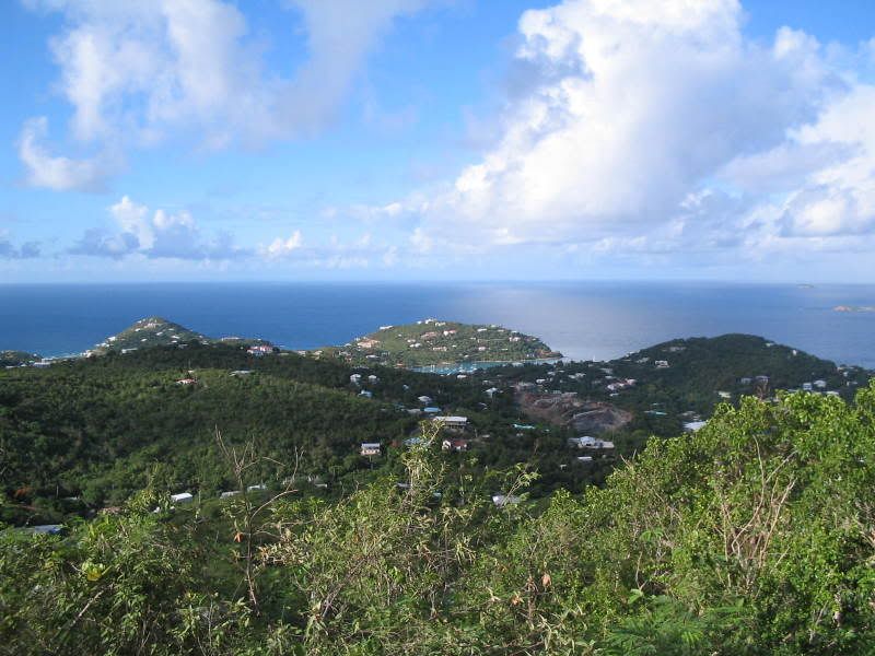
Turtle girl ya will love the veiw from Caneel Hill.Here would be a lot shorter route and still get to see the good stuff it will be all downhill to Caneel or flat then up Margeret Hill from Caneel then once at top of Caneel Hill down the Spur trail were ya started. Park at the National Park sign just past Estate Lindholm on Northshore three or four spaces there.Just use the green trails on the map. http://www.seestjohn.com/images/trails/ ... int001.jpg Nothin wrong with starting at the NPS in Cruz bay but thats one heck of a long hike unless you a super hiker this route will cut ALOT of time off and you will see all the good stuff. Think my buddy and I will do it next trip. Usually head up at Mongoose and head staight up it is a killer hike but worth it  Here a couple more angles from Caneel Hill
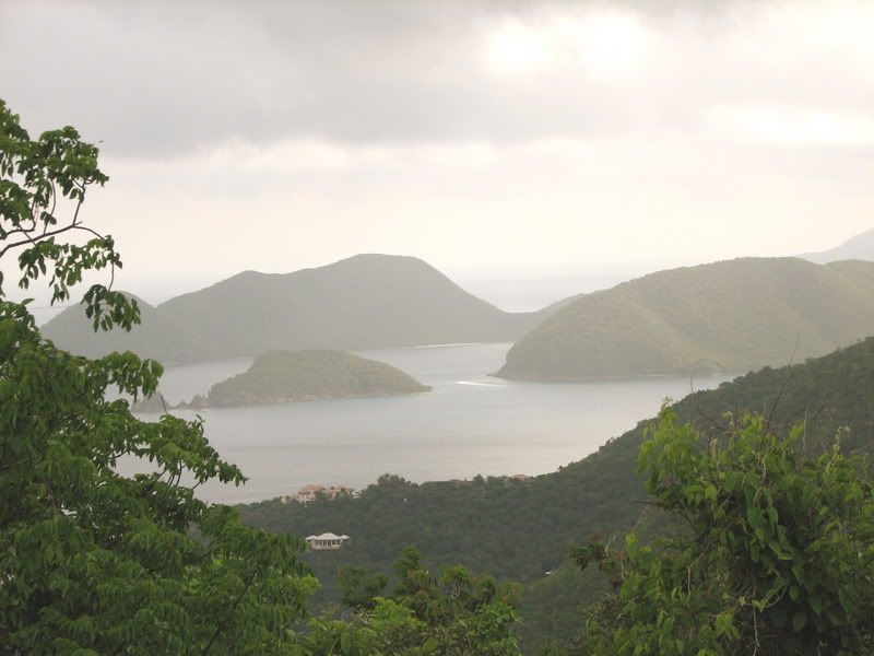
Looking towards Cinnamon
Looking towards Cinnamon
-
Dave-a-roni
- Posts: 299
- Joined: Fri May 25, 2007 1:43 am
- Location: Western NY
Turtlegirl wrote:
Besides Caneel Hill and Reef Bay, we'd like to do one more 2 hour plus hike and are looking at Johnny Horn trail as we won't have 2 vehicles. Is this a good option? Also, in STJOTBT, he recommends a Leinster Bay spur trail to be closer as you start your swim to Waterlemon Cay, does anybody do this?
Hi Turtle Girl, I just did the Johnny Horn Trail. I used the Leinster Bay trail to connect to the Johnny Horn trail, it's nice to hike along the water before you go up. I went all the way to Coral Bay, it's an easy hour and a half hike with some inclines but nothing major. I was in cloudy and drizzly weather so it wasn't too hot for me. The Brown Bay trail connects high up on the Johnny Horn (but I didn't have time
 ) I'm not sure how you'll do it with one car unless you get picked up in Coral Bay. If not, your looking at a 2 hour plus hike round trip if your turning around and going back to the Leinster Trail.
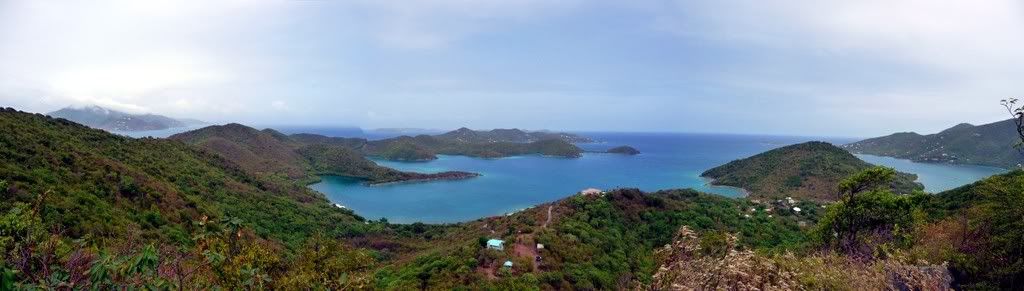
I do suggest however, to go up to Base Hill at the end of the Johnny Horn just as your about the drop into Coral Bay. This might be a great turn around point if your not doing it one way. It's not marked but it's a distinct trail to your left going up. I used the TrailBandit map that everyone is talking about, it's worth it.
It offers awesome views of Hurricane Hole (Popilleau Bay and Barck Creek). It's not much extra hiking and it's worth it. Here's a panoramic of Base Hill.
Happy hiking!
<a href="http://s173.photobucket.com/albums/w41/ ... asmall.jpg" target="_blank"><img src="http://i173.photobucket.com/albums/w41/ ... asmall.jpg" border="0" alt="Photobucket"></a>
Besides Caneel Hill and Reef Bay, we'd like to do one more 2 hour plus hike and are looking at Johnny Horn trail as we won't have 2 vehicles. Is this a good option? Also, in STJOTBT, he recommends a Leinster Bay spur trail to be closer as you start your swim to Waterlemon Cay, does anybody do this?
Hi Turtle Girl, I just did the Johnny Horn Trail. I used the Leinster Bay trail to connect to the Johnny Horn trail, it's nice to hike along the water before you go up. I went all the way to Coral Bay, it's an easy hour and a half hike with some inclines but nothing major. I was in cloudy and drizzly weather so it wasn't too hot for me. The Brown Bay trail connects high up on the Johnny Horn (but I didn't have time
I do suggest however, to go up to Base Hill at the end of the Johnny Horn just as your about the drop into Coral Bay. This might be a great turn around point if your not doing it one way. It's not marked but it's a distinct trail to your left going up. I used the TrailBandit map that everyone is talking about, it's worth it.
It offers awesome views of Hurricane Hole (Popilleau Bay and Barck Creek). It's not much extra hiking and it's worth it. Here's a panoramic of Base Hill.
Happy hiking!
<a href="http://s173.photobucket.com/albums/w41/ ... asmall.jpg" target="_blank"><img src="http://i173.photobucket.com/albums/w41/ ... asmall.jpg" border="0" alt="Photobucket"></a>
"Try to preserve nature where you live, not just where you visit"
Photo's
2008 http://www.flickr.com/photos/dave-a-ron ... 118102515/
2005 http://www.flickr.com/photos/dave-a-ron ... 326642810/
Photo's
2008 http://www.flickr.com/photos/dave-a-ron ... 118102515/
2005 http://www.flickr.com/photos/dave-a-ron ... 326642810/
-
turtlegirl
- Posts: 154
- Joined: Sat Mar 01, 2008 8:54 pm
- Location: Massachusetts