

Old STJ pictures coming!
Old STJ pictures coming!
When decluttering my bookshelves, I came across a book about STJ that I purchased years ago. I just sent off an email to the Friends of the VI Park asking if they were interested in the book as a donation.
The photos are interesting. The North Shore shots show no houses at all except for one house in the area of Peter Bay that I don't recognize.
The shots of Carolina ridge show cleared areas that look like pasture land and the same back from Maho Beach.
The Coral Bay hillsides are complete undeveloped and in "town" I can see just a handfull of houses.
Pictures of the cattle farm!
I am going to try to scan them in the next few days and post them on the web.
Does someone out there have a community folder of old STJ pictures? I would be happy to add these to the same folder.
Is that the Virgin Islands National Park "Story Behind the Scenery" published in 1974? The photos were by internationally known photographer Fritz Henle, a St. Croix resident...as a long time resident, it all looks normal to me.
There were quite a few houses on North Shore, they were just reasonably sized--like everything under 3000 square ft., so they don't show in that aerial shot.
For a LOT of St. John photos, from the 1890's on, go to the St. John Historical Society website http://www.stjohnhistoricalsociety.org
We'll look forward to your posting the Henle photos!
[/code]
I'd love to see the historical pictures...I think they're cool!....
STJ Villa Map:
http://maps.google.com/maps/ms?hl=en&ie ... 2&t=h&z=14
http://maps.google.com/maps/ms?hl=en&ie ... 2&t=h&z=14
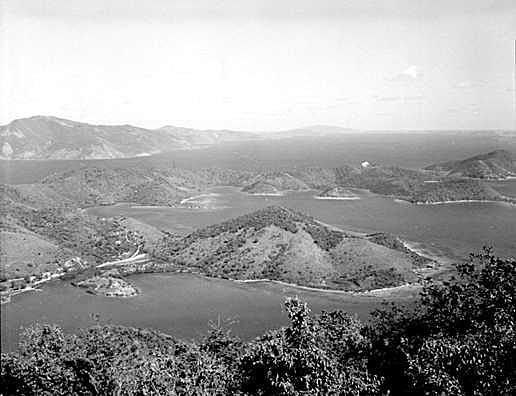
Look forward to these. Took this pic from the web of Coral from Borduex think it said in the 60s
This one was taken by me from Ajax Peak. Lots more buildings, but also way more lush with greenery had always heard the Island was more lush now than then.Pardon the Sahara dust in this pic.Kinda a reverse angle from the Bordeaux shot. Look at the left of Coral Bay how it has grown back from clearcutting or maybe it's because the other shot is a b&w pic
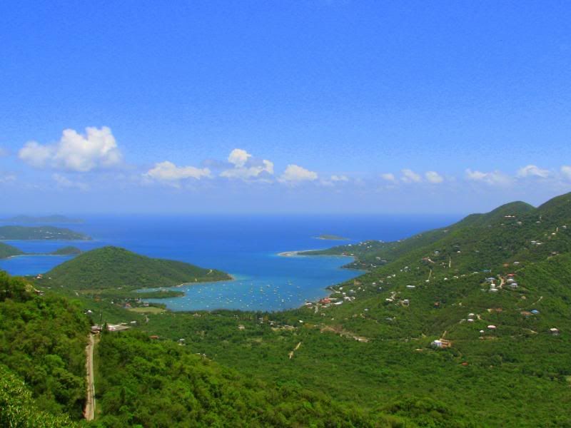
This one was taken by me from Ajax Peak. Lots more buildings, but also way more lush with greenery had always heard the Island was more lush now than then.Pardon the Sahara dust in this pic.Kinda a reverse angle from the Bordeaux shot. Look at the left of Coral Bay how it has grown back from clearcutting or maybe it's because the other shot is a b&w pic